None of these maps can help you find entrances et go down in the quarries. This is not the purpose of this web site. Please remember that going in the underground quarries of Paris is forbidden and can be dangerous if you don't take care.
 "La Plage" (The Beach) is perhaps one of the most known places of the quarries. Anyone going down in the quarries has to go at least once to La Plage.Placed on one of the principal circulation ways, this place is the first meeting point of the underground adventurers. They drink their first beer of the night, exchange hand-outs...The place got this name because of the sand used to fill some of it and that covers the ground, and the huge wave painted on a wall.
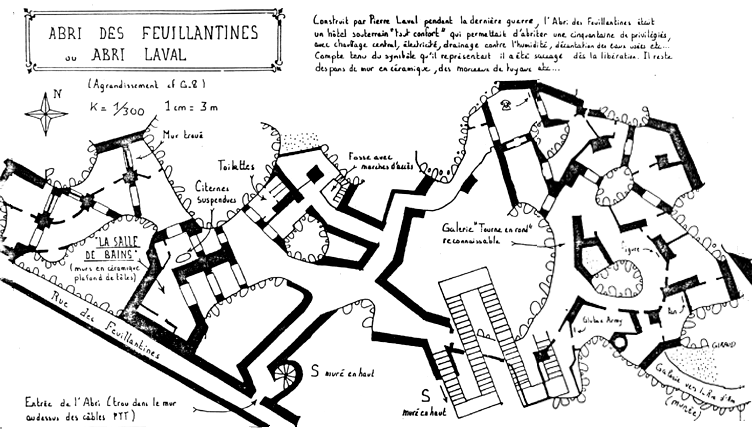 The "Abri des Feuillantines", also known as "Abri Laval" (Laval Shelter). Built by Pierre Laval (one of the heads of french government during world war II), it was not a simple shelter, it was an underground palace hotel. The floor was tiled, their was electricity, bathrooms, etc.
All the modern comfortSuch a symbol could not resist the liberation of Paris : it was completly destroyed.
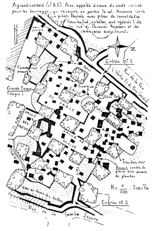
 One of the first tasks of the Inspection Générale des Carrières (IGC, General Inspection of the Quarries) is to draw maps of the underground quarries. This allows to evaluate risks, and be more efficient if an accident happens. In case of important constructions (such as a building), IGC studies maps to see if there's a risk, if the ground is too weak at this place...The document on the left if a small part of one of IGC's maps. (Atlas Souterrain des Carrières de La Seine, map #165 (16th arrondissement)). No quarry on this map but you can see an old shelter remaining fromWW2.
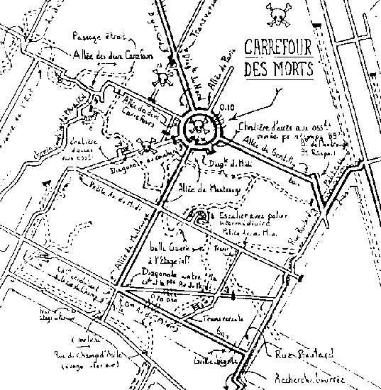 Under the cemetery of Montparnasse are several ossuaries. Used to empty the cemetery, bones were thrown into pits.
The "Carrefour des Morts" is one of the most famous ossuaries of the quarries. You can also see on this map the quoted lines that represent the corridors of the deeper level.
Under the cemetery of Montparnasse are several ossuaries. Used to empty the cemetery, bones were thrown into pits.
The "Carrefour des Morts" is one of the most famous ossuaries of the quarries. You can also see on this map the quoted lines that represent the corridors of the deeper level.
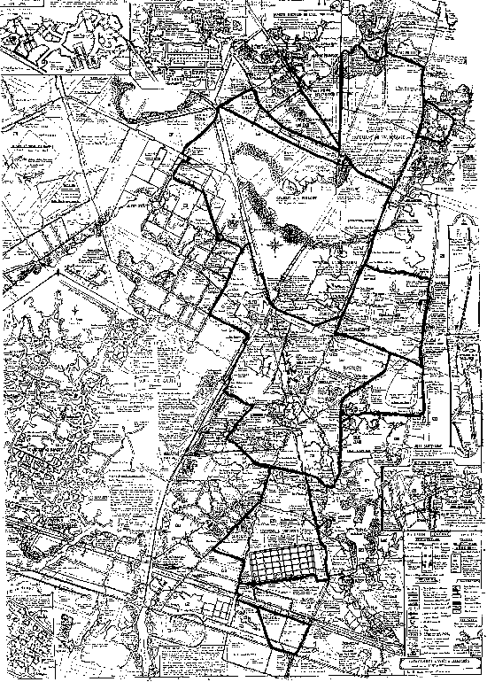 This is the whole view of the "Giraud" map. This map is the most beautiful and precise map of the quarries. On the left part you can see an enlarged map of the undeground of the Val de Grâce. The bold corridors are the most commonly used corrdiors.
The circle on the left of the compass is the "Carrefour des Morts", under Montparnasse Cemetery. In the center of a kind of polygon under the compass, is the official ossuary.
On the top left of the map : the enlarged map of the "Abri des Feuillantines".
This is the whole view of the "Giraud" map. This map is the most beautiful and precise map of the quarries. On the left part you can see an enlarged map of the undeground of the Val de Grâce. The bold corridors are the most commonly used corrdiors.
The circle on the left of the compass is the "Carrefour des Morts", under Montparnasse Cemetery. In the center of a kind of polygon under the compass, is the official ossuary.
On the top left of the map : the enlarged map of the "Abri des Feuillantines".
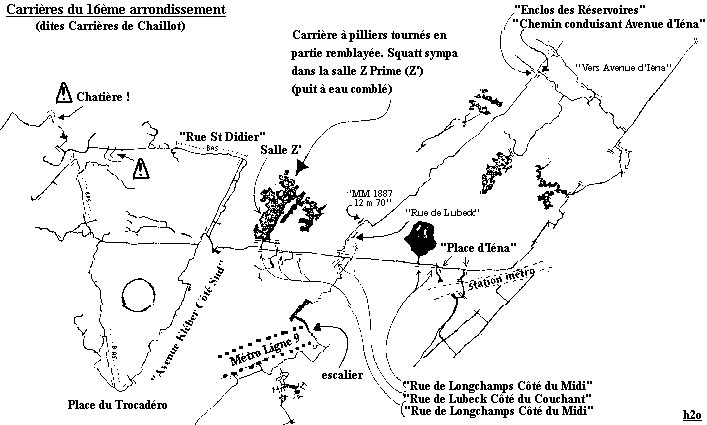 The "Carrières de Chaillot", i.e. the 16th arrondissement quarries (in fact the main network).
Closed in january 1995 because of two stupid "tourists" that had an accident, this network is one of the most beautiful of Paris. In its bottom part, it goes from Iéna to Place du Trocadéro.
There are still some parts of what has been built there for the Universal Exhibit of the beginning of the century : a egyptian grave, the Channel Tunnel, and a coal mine.
There is also a corridor just up the platforms of the Iéna Métro station.
The "Carrières de Chaillot", i.e. the 16th arrondissement quarries (in fact the main network).
Closed in january 1995 because of two stupid "tourists" that had an accident, this network is one of the most beautiful of Paris. In its bottom part, it goes from Iéna to Place du Trocadéro.
There are still some parts of what has been built there for the Universal Exhibit of the beginning of the century : a egyptian grave, the Channel Tunnel, and a coal mine.
There is also a corridor just up the platforms of the Iéna Métro station.
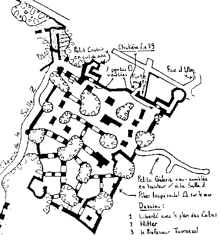
"Salle Z" (~ The Z Room).
This room is one of the most famous rooms of the quarries. The origin of the name is not really known. It could have been used by a secret group of people that used it to meet.
Another explanation is that this room is on the a far side of the network.


